
Ground Penetrating Radar
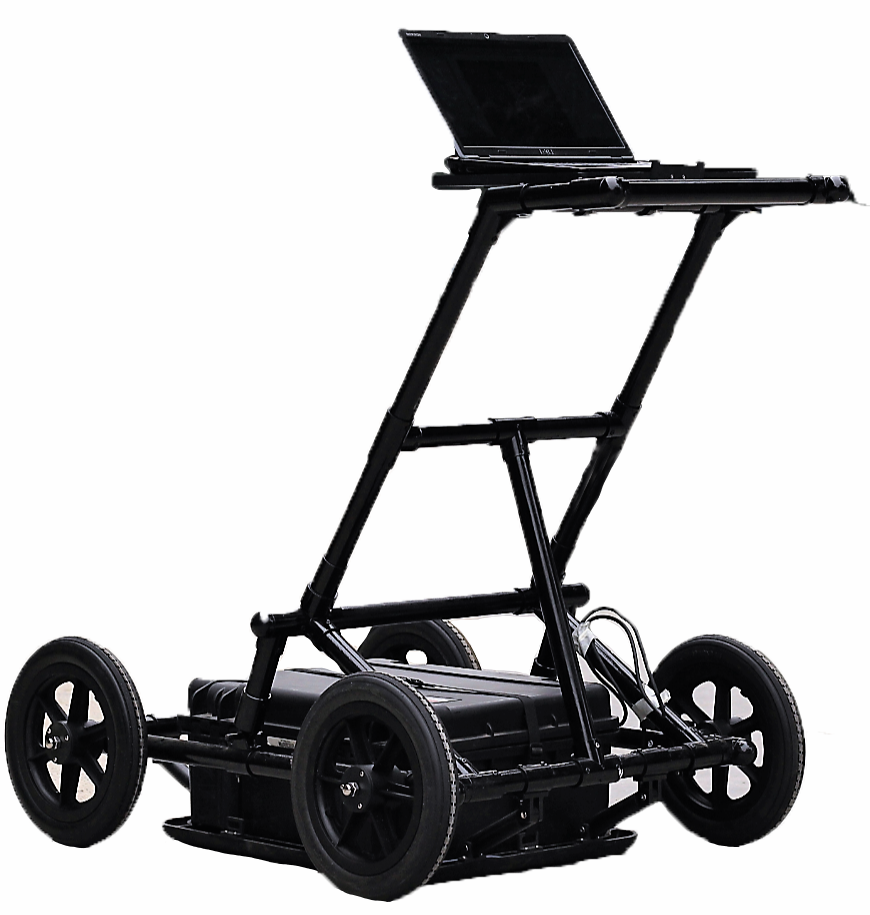
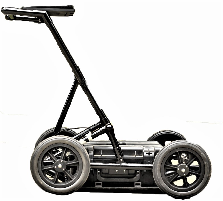
It is suitable for engineering survey, municipal pipeline, road bridge, tunnel testing and other fields to detect or ascertain the information of metal or non-metallic objects in a certain depth of the underground. The specific classification is as follows:
◆Engineering Investigation: information for identifying underground unfavorable geological bodies in the engineering area, such as karst, collapse and fractured zone.
◆Municipal pipelines: identify the distribution of underground metal or non-metallic pipelines in the process of urban construction.
◆Road and Bridge: used to identify bad geological bodies in the process of site selection.
◆Tunnel detection: used for advanced prediction of tunnel and quality of tunnel construction.
◆This product adopts the integrated design of the main engine and antenna in the industry, which is small in size, light in weight and low in power consumption.
◆The mainframe and the computer wireless connection, the operation is convenient;
◆Realize real time data collection and display;
◆The software interface is succinct, easy to operate and quick to use.
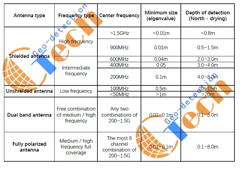
◆The multi band antenna is optional, and its application range is wide.
◆The analysis software is easy to operate and the result is accurate.
◆The detection accuracy is high, the location is accurate, and the resolution can reach up to 1mm.
◆Built-in super large capacity battery, long endurance.
◆The structure design of ergonomics is simple, durable and easy to operate. It is very suitable for mobile working environment in the field.
Model | GT-GPR |
Antenna Frequency | 100MHz/200MHz/400MHz/1GHz/2GHz |
Sampling Frequency | 0.2-100GHz |
Time Window Range | 1ns~200000s |
Sampling Point Number | 512~8192 points |
Scanning Rate | 6~480 points/s |
A/D Conversion | 24 bit |
Continuous Working Time | ≥8 h |
Overall Power Consumption | <6 W |
Minimum Sampling Interval | <2ps |
Measurement Mode | Point by point measurement, distance trigger measurement, continuous measurement |
Display Mode | Pseudo color map, stacked wave or gray scale |
Working Temperature | -30℃~+70℃ |
Working Voltage | 11-15V DC |
Wireless Data Transmission Distance | >50 m |
Wired Communication | Ethernet ,100Mbps |
Weight | ≤5kg |
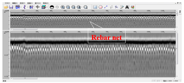
Display mode: real time color display, color / gray scale line scanning, variable area / waveform display, 256 color sources can be used to express the amplitude and polarity of the signal in linear scanning.
Radar software package enriches the application of radar system. In addition to equipped special radar data processing software, users can also select software modules of special functions according to their own needs, and can carry out data processing on the PC machine. Modules include:
◆The automatic tracking software for highway surface is used for Highway Survey and automatic removal of interference. The hierarchical automatic tracking analysis of Expressway structure shows the spreadsheet of pile number, layer thickness and thickness deviation.
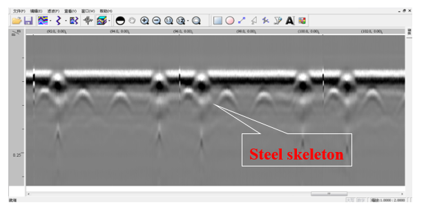
◆Structural scanning tool kit: three dimensional depth slice, steel mesh perspective, pipeline location, display of voids and cracks in buildings.
◆Rapid 3D mapping software: 2D inversion, 3D processing and display, 3D and 2D visualization visualization of municipal facilities.
◆Building structure analysis software: steel distribution depth positioning display, municipal pipeline distribution positioning.
◆Software for bridge structure and corrosion analysis: software for determination and analysis of bridge reinforcement distribution and corrosion

Copyright © Geo-Detection & Technology Co.,ltd All Right Reserved. +86027-68788618
No. 18008106, ICP, Hubei